Topographical Land Surveys
Surveys For Engineers, Builders, And Developers
- Detailed Site Mapping Accurate contour and elevation surveying services.
- Experienced Surveying Professionals Reliable land surveying backed by local expertise.
- Responsive Local Service Fast communication with dependable project support.
- Accurate Property Data Detailed topographic mapping for project planning.
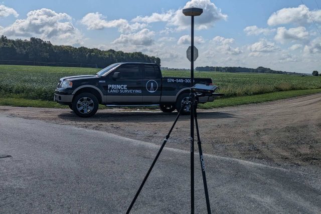
Accurate Elevation and Site Data for Your Next Project
Prince Land Surveying provides professional topographical land surveys for residential, commercial, agricultural, and construction projects throughout Northern Indiana. Our team helps property owners, builders, engineers, architects, and developers gather the accurate land elevation and surface data needed for successful planning and development.
Topographical land surveys provide detailed information about the contours, elevations, and physical features of a property, giving project teams a clear picture of the site before work begins.
What you can expect from our team:
Decades of combined surveying experience
Strong local knowledge across Northern Indiana
Detailed contour and elevation data for confident planning
Responsive communication throughout your project
Dependable service from start to finish
What Is A Topographical Land Survey?
Topographical land surveys document the natural and man-made features located on a property while showing elevation changes and land contours. Engineers, architects, developers, and contractors use topographic surveys during site planning, drainage design, grading, construction preparation, and land development projects.
Accurate topographic information helps project teams understand how the land currently exists before construction or development begins. This information improves planning, supports design accuracy, and helps reduce unexpected issues during construction.
A topographical land survey may include:
- Elevation contours
- Existing buildings and structures
- Driveways and parking areas
- Utilities and drainage features
- Trees and vegetation
- Retaining walls and fences
- Surface improvements
- Terrain changes and slopes
Topographical Surveys For Residential And Commercial Projects
Prince Land Surveying provides topographical land surveys for a wide range of projects throughout Northern Indiana, including residential improvements like new construction, additions, driveways, seawalls, and outdoor living areas, as well as commercial developments, agricultural properties, construction projects, and municipal planning efforts. We understand that every property presents unique challenges, so we focus on clear communication, accuracy, and dependable turnaround times to keep your project moving forward efficiently.
Our Topographical Survey Process
Prince Land Surveying handles every phase of the surveying process in-house to provide a more streamlined and efficient experience for our clients. We begin by gathering project information, reviewing property records, and discussing the specific goals and requirements for the survey.
During fieldwork, our team uses modern surveying technology to collect precise elevation and location data across the property. We then compile the information into detailed topographic maps and survey documents that support planning, engineering, and construction projects.
Our topographical land survey process typically includes:
- Initial consultation and project review
- Research of plats, deeds, and property records
- Fieldwork and site elevation data collection
- Location of existing features and improvements
- Surface contour calculations and mapping
- Preparation of detailed topographic survey documents
Topographical Land Surveys Support Better Planning
Accurate topographical land surveys help property owners, engineers, and contractors make informed decisions before construction begins. Without accurate elevation and site data, projects may encounter drainage problems, grading issues, construction delays, or unexpected site conditions that increase costs and impact timelines.
Builders, developers, and engineers often rely on topographical land surveys to create more efficient project plans while reducing risks during development and construction.
Topographic surveys help our clients:
- Improve site planning and design
- Support grading and drainage plans
- Prepare for construction projects
- Identify elevation changes and slopes
- Locate existing site improvements
- Reduce costly construction surprises
- Improve project accuracy and efficiency
Superb customer service. I highly recommend this company.
Areas Served
Trusted Local Land Surveyors in Northern Indiana
Prince Land Surveying serves clients throughout Kosciusko County and the surrounding region.
Our team works with homeowners, landowners, builders, realtors, title companies, and contractors who need dependable land surveying services from experienced local professionals.